


| SEARCH |
-

Nov 17, 2015
Reflections on a three-decade legacy
The International Geosphere-Biosphere Programme (IGBP) will come to a close at t...
-
Nov 17, 2015
Use of and access to content on this website
Text and images produced by IGBP in house are free to use with appropriate credi...
-
Nov 12, 2015
Bella Gaia performance and panel discussion to mark IGBP's closure
A musical performance by Bella Gaia will celebrate the achievements and legacy o...
-

Towards Future Earth:
evolution or revolution?
During its three decades of existence, the International Geosphere-Biosphere Pro...
-
A personal note on IGBP and the social sciences
Humans are an integral component of the Earth system as conceptualised by IGBP. João Morais recalls key milestones in IGBP’s engagement with the social sciences and offers some words of advice for Future Earth.
-
IGBP and Earth observation:
a co-evolution
The iconic images of Earth beamed back by the earliest spacecraft helped to galvanise interest in our planet’s environment. The subsequent evolution and development of satellites for Earth observation has been intricately linked with that of IGBP and other global-change research programmes, write Jack Kaye and Cat Downy .
-
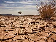
Deltas at risk
Around 500 million people worldwide live on deltas, but many of the world's deltas are sinking due ...
-
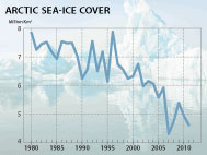
Climate change: the state of the science
A new data visualization released on the first day of the plenary negotiations at the UNFCCC’s clima...
-
Climate Change:
the State of the Science
Videos now online from the Stockholm public forum to mark the launch of the IPCC's climate report, 2...

photo: NASA Earth Observatory images by Jesse Allen,
using Landsat data from the U.S. Geological Survey.
First published in IGBP's Global Change magazine 84, November 2015
IGBP and Earth observation:
a co-evolution
The iconic images of Earth beamed back by the earliest spacecraft helped to galvanise interest in our planet’s environment. The subsequent evolution and development of satellites for Earth observation has been intricately linked with that of IGBP and other global-change research programmes, write Jack Kaye and Cat Downy.
Jack Kaye, a longstanding supporter of IGBP, is Associate Director for Research of the Earth Science Division (ESD) within NASA’s Science Mission Directorate (SMD).
Cat Downy is IGBP-ESA Liaison Officer, based at the ESA Climate Office, ECSAT, UK.
Going back to 1987, when IGBP was created, there was much we did not know about our home planet. The discipline of Earth-system science – the study of Earth as a connected system – was in its infancy, having been proposed by NASA in its ‘Bretherton Reports’ (1). The modern era of satellite observations had only recently begun; scientific disciplines as well as the international community were much less integrated than they are today. The models that Earth scientists used to describe Earth’s behaviour and its future changes were much more “component-based”. Moreover, the international assessments that help to unite the community and distil enormous amounts of information into forms usable for scientists and policymakers were just getting under way: the WMO/UNEP ozone assessments did not gather steam until the mid-1980s, whereas the IPCC was not set up until 1988. That we find ourselves in a very different situation today is due in no small part to the efforts of the IGBP scientific community.


Figure 1. Landsat downloads. Beginning 1 October 2008, Landsat data could be downloaded freely. This had an immediate impact: the number of scenes downloaded increased manifold during the next few years. (NASA's Goddard Space Flight Center and the U.S. Geological Survey. http://svs.gsfc.nasa.gov/vis/a010000/a011400/a011458/)
New technology, new uses
Satellites began to observe our planet in the 1970s; the first passive microwave images were taken from NOAA’s Nimbus 5 in 1972, swiftly followed by measurements of ocean colour and ozone from instruments on Nimbus 7. TIROS-N gave us the first in the long-running AVHRR sensor series and an atmospheric sounding system. Early developments in this field were led by the United States, but planning for Europe’s ERS-1 satellite began in 1977: it was to observe water and ice to plug what was then a major data gap.
By the mid-1980s Earth-observation data were of sufficiently long duration to allow scientists to look at interannual variability. This is when the research community really started making significant use of these data. The Landsat 5 satellite that was to become a major source of global land-cover data was launched in 1984 – the same year that the Committee on Earth Observation Satellites (CEOS) was set up to coordinate and harmonise observations to facilitate access to and use of data. Today, the space agencies participating in CEOS have more than 100 Earth observation missions in orbit (www.ceos.org).
Many other satellites that provided new views of the Earth did not launch until shortly after the creation of IGBP – the Upper Atmosphere Research Satellite (UARS) in 1991 and Topex/Poseidon in 1992 are just two examples – each of which also represented international collaborations. The European Space Agency (ESA) launched its European Remote Sensing (ERS) satellites ERS-1 and ERS-2 in 1991 and 1995, respectively. Japan’s first Advanced Earth Observing Satellite (ADEOS-1) was launched in 1996. Planning for NASA’s Earth Observing System (EOS) had begun around the time, building towards launches of satellites such as Terra, Aqua and Aura in 1999, 2002 and 2004, respectively. Satellite observations were integrated with field campaigns that combined surface-based and airborne observations. The First ISLSCP Field Experiment (FIFE), set up in 1987, was one of the earliest field campaigns that integrated both satellite and field data to study Earth-system behaviour. Other examples include the Boreal-Ecosystem-Atmosphere study in the US and Canada (1994-1996); the Large-scale Biosphere-Atmosphere Experiment in Brazil that began in 1998 (but for which planning started in 1993; see box); the polar ozone airborne campaigns in the Antarctic (1987) and Arctic (1989, 1992); and Global Troposphere Experiment (GTE) series of airborne campaigns going back to 1983 and continuing into the early 21st century.
In 1993 IGBP launched its Data and Information System (IGBP-DIS) project to help develop critical data sets and enable effective data-management systems. At the time of its inception, access to Earth observation data wasn’t easy and was very costly, which limited the extent to which satellite data could contribute to research. Together with CEOS, IGBP-DIS spearheaded an initiative to gather key data sets identified by the community at a reduced price from the space agencies. The resulting 1km AVHRR data set was one of the main driving forces in improvements in global land data sets. Subsequent work resulted in the development of data principles in support of the operational use of satellite data for public benefit. The first freely available medium-resolution imagery dates to 2004, and access to Earth-observations data has improved greatly since then. In particular, the decision in 2008 to release the current and archived Landsat data encouraged far more people to use the data than before (Figure 1). The commitment from many space agencies to free and open data policies continues today, as demonstrated by the recently agreed policy for Copernicus’ Sentinel data and the release of the highest-resolution topographic data from NASA’s Shuttle Radar Topography Mission (SRTM).

Figure 2. The ESA-SOLAS OceanFlux Greenhouse Gases project used satellite data to re-analyse Surface Ocean CO2 Atlas (SOCAT) measurements, enabling the study of global CO2 atmosphere-ocean gas fluxes (Goddijn-Murphy et al. 2015 Ocean Sciences 11: 519-541, doi:10.5194/os-11-519-2015).

Convening communities, setting agendas
As the scientific community put this new observing capability to use, it led to research into some very visible and societally important topics: the Antarctic ozone hole discovered in the mid-1980s was actively investigated and the large 1987–1988 El Niño event (followed by a large La Niña event) provided particular foci for interdisciplinary observational and modelling studies. We came to measure the increasing rate of ice loss from the polar regions and regional rates of sea-level rise. Making sense of all these data and figuring out what they meant for the planet’s future required sophisticated Earth-system models. IGBP – by virtue of its ability to bring together different disciplines, communities and nations – was at the forefront of the development of models that combined physics, chemistry and biology. Such models now include realistic representation of the Earth’s carbon cycle and associated biology and biogeochemistry. IGBP not only provided a forum for model development but also facilitated inclusive model-model and model-observation intercomparison activities.
IGBP’s convening capacity is unparalleled: it played a particularly important role in bringing increased international participation into the NASA-initiated Northern Eurasia Earth Science Partnership Initiative (NEESPI) by endorsing it as an External Project in 2006. With this broader support NEESPI has become a highly successful programme. “The global research programmes have been vital in improving the interface between Earth observation and the Earth-system science community and in making sure the science community can get full value from the ESA programme,” says Stephen Briggs, Senior Advisor to ESA’s Earth Observation Programme, who initiated a Research Fellowship jointly between ESA and IGBP. “Input from the global change programmes helped enormously in orienting ESA satellite and applications development programmes, such as the recently selected Earth Explorer mission, BIOMASS. The IGBP community has played a significant role in setting the agenda for Earth-system science, and guiding ESA’s priorities in the exploitation of satellite data.” Dedicated joint projects between ESA and IGBP, such as the OceanFlux projects between ESA and the Surface Ocean-Lower Atmosphere Study (SOLAS; Figure 2), have helped strengthen this interface with Earth-system science researchers.
Looking back at its founding documents, the authors of “Toward an IGBP” (2) realised that “progress in understanding global change will require extensive and well-organised observations made over much of the Earth and over a long period of time.” Good progress has been made in coordinating and broadening Earth observation product use but it is crucial that we continue to do this in partnership with Future Earth. We hope Future Earth will combine the strong emphasis on advancing fundamental physical and biological science that IGBP and its partners have nurtured with increasing global efforts to use that knowledge to improve the quality of life for all the world’s citizens.
The space agencies and scientific community all owe a debt to those who contributed their time and effort towards making IGBP such a valuable contributor to, and resource for, the Earth-system science community.
The LBA legacy
The Large-scale Biosphere-Atmosphere Experiment in Amazonia (LBA) is a multinational, interdisciplinary research programme led by Brazil through its Ministry of Science and Technology. Its goals are to understand how Amazonia functions as a regional entity in the Earth system and how those functions are responding to ongoing changes in land use and climate. The LBA as a research programme grew out of a demand from scientists linked to the IGBP. Given this linkage, the LBA can be understood as a product of IGBP in conjunction with other research programmes that operated in the region. Its institutional relationship with the IGBP research effort on global change directly affected the formulation of its research questions, design and institutional arrangement. LBA scientific activities cover seven themes: (1) land-use and land-cover change, (2) physical climate, (3) carbon dynamics, (4) biogeochemistry, (5) atmospheric chemistry, (6) land-surface hydrology and aquatic chemistry, and (7) human dimensions. LBA research has contributed to the advance of scientific understanding and expansion of technical and human capacity to help frame local and national development and conservation issues. Integrating bottom-up and top-down measurements has been a key aspect of LBA. Socio-economic drivers related to logging, ranching, farming, and infrastructure have been integrated into land-use models, which have been used as effective tools for demonstrating scenarios and trade-offs of future land cover, carbon stocks, water resources, conservation and economic development. Remote-sensing tools have been developed and operationalised to improve monitoring of deforestation rates, logging activity and forecasting of regional air pollution. Beyond specific research findings, LBA research has contributed to the process of framing development and conservation issues with up-to-date science through a deliberate planning process that fostered interdisciplinary science and training and education. A new generation of young South American scientists has been trained to develop and use these tools and their underlying science.
– Mercedes Bustamante and Michael Keller
References and notes
1. Earth System Science Overview: A Program for Global Change. Earth System Science Committee, NASA Advisory Council. 1986.
2. Toward an International Geosphere-Biosphere Program: A Study of Global Change. Report of a National Resources Council workshop. National Academy Press, Washington, DC. 1983.


IGBP closed at the end of 2015. This website is no longer updated.
-

Global Change Magazine No. 84
This final issue of the magazine takes stock of IGBP’s scientific and institutional accomplishments as well as its contributions to policy and capacity building. It features interviews of several past...
-

Global Change Magazine No. 83
This issue features a special section on carbon. You can read about peak greenhouse-gas emissions in China, the mitigation of black carbon emissions and the effect of the 2010-2011 La Niña event on gl...
-
INTERGOVERNMENTAL PANEL ON CLIMATE CHANGE:
How green is my future?
UN panel foresees big growth in renewable energy, but policies will dictate just how big.
-
UK:
'The Anthropocene: a new epoch of geological time?'
Royal Society, Philosphical Transactions A